
Mission Planning
Coverage planning over the search boundary, and the simulator used to choose ASCENT-1's search strategy before a single real flight.
Overview
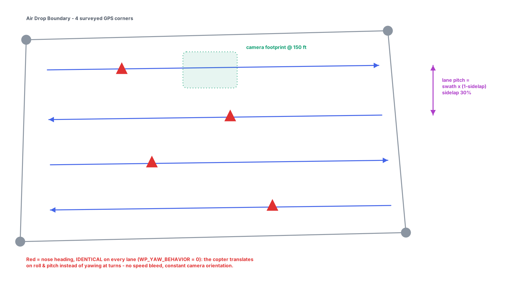
The Mission Planning subsystem decides how ASCENT-1 searches. It takes the competition's Air Drop Boundary — a quadrilateral of four surveyed GPS corners — and generates a coverage plan the aircraft flies as an ordinary ArduPilot AUTO mission.
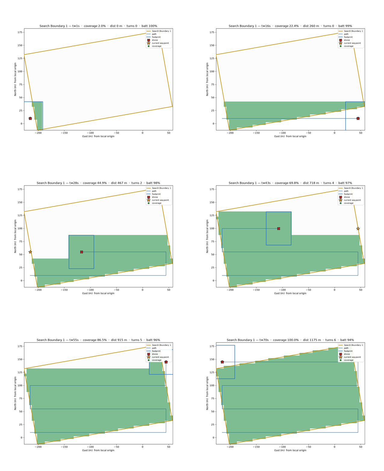
The search strategy itself was not chosen by intuition: the team built a dedicated SUAS Search Simulator around the official RoboNation mission map and compared candidate planners under identical conditions before committing one to the aircraft.
Engineering Objectives
- Generate efficient, repeatable coverage of the search boundary.
- Choose the search strategy on evidence, not intuition.
- Produce a mission that ends safely even if the companion computer fails.
- Keep planning parameters consistent between simulation and the real flight.
Major Components
Search Simulator
A research platform that evaluates search algorithms on the official mission map with Monte-Carlo campaigns.
Coverage planner
Computes swath width from camera FOV and altitude, overlaps lanes by 30% sidelap, and lays a boustrophedon path.
Mission Planner GCS
The ground station used to review boundaries and monitor the aircraft over the 900 MHz link.
AUTO mission builder
Uploads the plan as an ArduPilot AUTO mission with a final RTL item.
Evaluation metrics
Mission time, coverage, energy, and search efficiency scored across simulated runs.
Target estimator
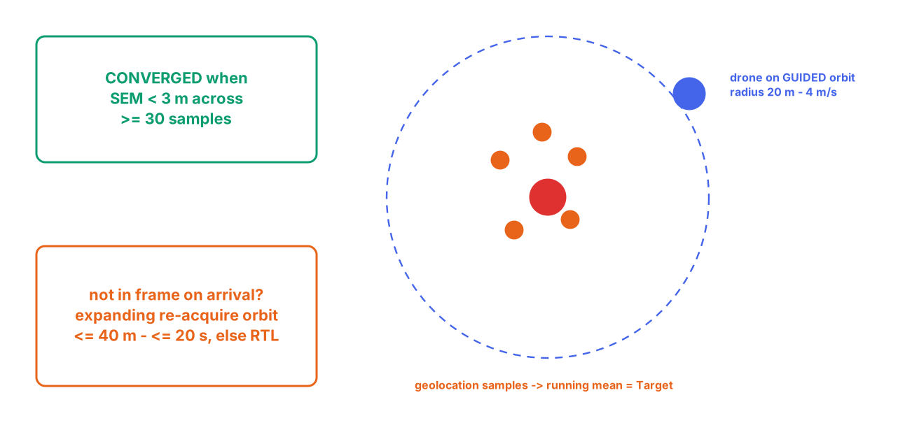
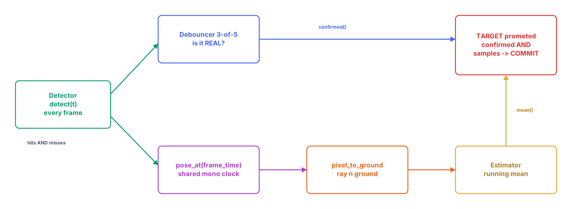
A running-mean geolocation estimate that converges during the LOITER orbit.
Integration with ASCENT-1
Mission Planning hands its coverage plan to Autonomous Flight as a verified AUTO mission and inherits the endurance estimate from Power Systems to keep the plan within battery.
The simulator's evaluation guided the Lawnmower strategy now deployed, and the same corner coordinates and parameters are used in SITL rehearsals so the planned mission matches the flown one.
Subsystem Architecture
Engineering Gallery
Technical Highlights
Evidence-based strategy
The search algorithm was selected in simulation before it ever flew.
Reproducible campaigns
Monte-Carlo runs compare planners under identical, seeded conditions.
Fails safe
The uploaded AUTO mission ends in RTL, so a dead companion still lands the aircraft.
Sim matches flight
The same boundary and parameters drive both SITL and the real mission.
- Add the remaining planned search algorithms to the simulator for re-evaluation.
- Incorporate live wind and battery state into in-flight plan adjustments.
- Automate boundary import directly from the competition KML.